Powered by WUFT
Temporarily change filter
Finding your station


A strong cold front will approach Florida this weekend, signaling the start of a new season in the Sunshine State. Finally.
September wasn't just hot. It was the hottest on record for many cities across north and central Florida. The unusual warmth also continued into October. The first half of the month was within the top five warmest for every reporting station in the state, according to the Southeast Regional Climate Center.
This will all change suddenly on Sunday. But only for the northern two-thirds of the state.
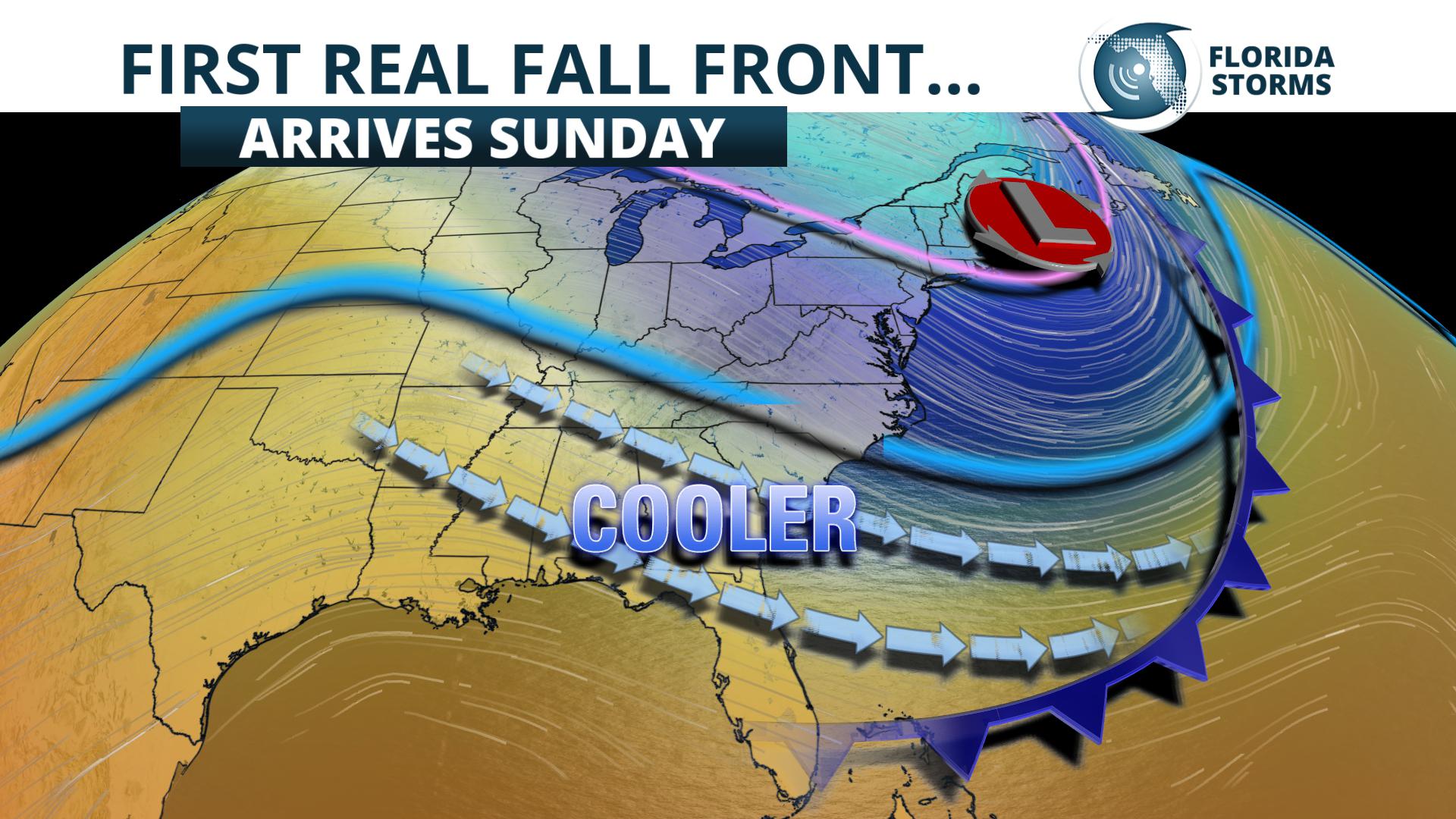
The jet stream will steer a much cooler air mass into the Southeast this weekend.
The season's first strong cold front will arrive in the Florida panhandle Saturday evening, then push all the way to the central parts of the peninsula Sunday. A noticeably drier and cooler air mass will replace the recent warm and humid one. In many areas north of I-4, the temperature will drop by nearly 15 degrees from Saturday to Sunday afternoon. Highs will only reach the lower and middle 70s along the I-10 corridor, and likely even fall short of 80 as far south as Ocala. Lower 80's are in the forecast Sunday afternoon from Tampa to Orlando, but this too will be very noticeable given the drop in humidity.

Forecast lows Monday morning
The coldest air mass of the young fall season will continue to settle in to north and central Florida Sunday Night. Many Floridians will have to dust off the heavier coats, as morning lows dip into the upper 40s along and north of I-10, and well into the 50s from The Villages to the Nature Coast. 50's are also possible in rural areas from Lakeland to Fort Myers around daybreak Monday, but urban areas along the I-4 corridor from Tampa to Orlando will likely only dip into the middle 60s.
Much of South Florida, especially southeastern sections of the state, will not experience a significant temperature drop from this front, which isn't that unusual for this time of year. The first cold front typically doesn't reach Miami until the last week of October or first week of November. Temperatures will, however, return to near-normal values for this time of year. Highs will be in the upper 80s and overnight lows in the lower 70s from Miami to West Palm Beach.
1885 Stadium Road
PO Box 118405
Gainesville, FL 32611
(352) 392-5551
A service of WUFT at the University of Florida College of Journalism and Communications


Partners of the Florida Public Radio Emergency Network include: Florida's Division of Emergency Management, WDNA (Miami), WFIT (Melbourne), WMFE (Orlando), WFSU (Tallahassee), WGCU (Fort Myers), WJCT (Jacksonville), WKGC (Panama City), WLRN (Miami), WMNF (Tampa-Sarasota), WQCS (Fort Pierce), WUFT (Gainesville-Ocala), WUSF (Tampa), WUWF (Pensacola) and Florida Public Media.
This page uses the Google Privacy Policy and UF's Privacy Policy
